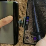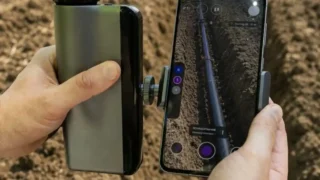


German technology company 3TAG has introduced a handheld RTK GNSS surveying system aimed at precision agriculture, extending a platform originally developed for construction and landscaping into farming applications. The portable device combines RTK GNSS positioning, laser height measurement and on-device reporting in a single unit, delivering centimetre-level positioning accuracy for tasks such as field elevation mapping, drainage design, irrigation planning and underground infrastructure location. By eliminating the need for separate field software and office-based post-processing, the system is designed to make high-precision surveying accessible to a wider range of farm operators.
Unlike conventional RTK receivers used primarily for machine guidance, the 3TAG platform focuses on capturing high-quality geospatial data that can be exported through open APIs into farm management, GIS and machine-control systems. The company says the device achieves 1–2 cm horizontal and 2–3 cm vertical accuracy under RTK conditions and supports multiple correction services. As precision agriculture increasingly relies on accurate terrain models for water management, controlled drainage and land levelling, portable surveying tools are becoming an important complement to autosteering and variable-rate technologies rather than simply another positioning device.
Bottom Line: The launch highlights an emerging trend in precision agriculture: the democratisation of high-precision field surveying. Traditionally confined to specialist surveyors using expensive GNSS equipment, centimetre-accurate terrain mapping is becoming easier for farmers and agronomists to perform directly in the field. As digital farming shifts from guidance to comprehensive geospatial management, handheld RTK platforms are likely to become an increasingly important layer in the precision agriculture technology stack, supporting better drainage, irrigation, field design and long-term land optimisation.